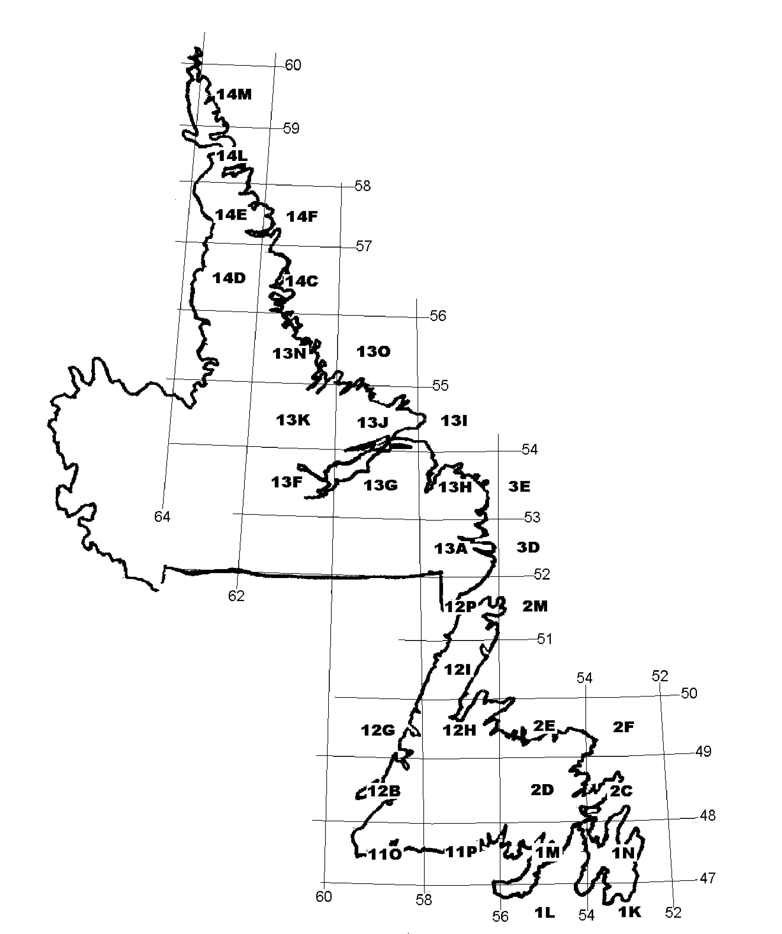
Click on a map grid to see the abandoned communities on that map for the Island; Labrador commnities do not have map excerpts.
Note: Not all communities may appear in map lists. See Main Index or Regions Index for complete list.
|
| The National Topographic Service divides the surface of Canada into sections 2° in longitude by 1° in latitude, each mapped at a scale of 1:250,000. Each 1:250,000 (eg. 12H) map is divided into 16 maps at 1:50,000 scale (eg. 12H/1, 12H/2, etc.), numbered from the bottom right of the 1:250,000 map in alternating rows. This gazetteer has the relevant 1:50,000 map reference in the second column of each entry. |
|
index guide to 1:50,000 scale maps |
| 13 | 14 | 15 | 16 |
| 12 | 11 | 10 | 9 |
| 5 | 6 | 7 | 8 |
| 4 | 3 | 2 | 1 |